Showing posts with label William Smith. Show all posts

Tuesday, 7 April 2015

BCS President's Bulletin March 2015


This year sees the 200th Anniversary of William Smith’s first Geological Map of England, Wales and part of Scotland, an event that was launched at the London headquarters of the Geological Society on March 23rd and attended by Sir David Attenborough. Known as ‘Strata Smith’ and ‘the Father of Geology’, Smith’s map is one of those truly iconic items in cartography. It is a ‘First’ that has set the standard for what has followed over the subsequent 200 years. A work of beauty, as well as being ground-breaking in the field of geology, the map has very much survived the test of time and has now been given a very modern twist on its own William Smith Bicentennial website www.strata-smith.com, where you can view an interactive 3D model that combines Smith’s original cartography with both modern cartography and technology. His accuracy, given the rudimentary tools of the day, takes your breath away. As Sir David mentioned, "Thinking in three dimensions is a remarkable ability. I know because I haven't got it."

This year also sees the 200th Anniversary of the Battle of Waterloo and the 600th Anniversary of the Battle of Agincourt as well as several centenary commemorations for battles of the First World War. The Historical Military Mapping Group of the BCS is heading across the Channel in April to visit Amiens and some of the venues in northern France that still evoke so many memories. Over 30 people have signed up and convener John Peaty is still looking for help in running this Special Interest Group.

The selection of papers and workshops for the BCS Symposium in York has now been made and the programme will be published shortly, with details available on the BCS website. We had a very good level of submissions this year covering a wide range of topics and hopefully there will be something of interest for everyone. As this is the March bulletin and the last one before the Awards close here is one final reminder that the usual BCS Awards close at the end of April and if you are planning on submitting an entry then time is running out. Full details of the Awards and how to enter for them are on the website, http://www.cartography.org.uk/default.asp?contentID=579. Now why did I say “usual”? If you have been following our twitter feeds, especially @Mappooch, the Awards Officer, you will already have spotted that we will be presenting a one-off Award this year sponsored by Google. The UK General Election is one of the most mapped events in the political calendar and with what promises to be a very closely contested and complicated election, just how well will these maps convey the final outcome? Well, now is your chance to impress the judges by producing a map of the General Election Result. Whilst paper maps are eligible for submission, preference will be given to online mapping with an emphasis on clarity and accuracy, with a deadline for submission of 30th June. Full details may be found in the Awards section on the website.


Cartography on the Internet

There have been several articles in the press recently about driverless cars, with most correspondents expressing concerns over safety on the road. One major implication of this technology was highlighted in a recent article in The Washington Post, the fact that the navigation systems for these cars will have to be much more accurate than those on current sat navs. The maps that appear on smart phones and sat navs are designed in part to replicate their paper equivalent and give the driver an easily recognisable symbolic representation of the real world. When the driver has been taken out of the equation to a large extent, and the car is doing the navigating as well as the driving, then directions and distances will be need to be much more accurate. Complex junctions will need to be mapped in far greater deal in order that we don’t have carnage on the roads. The technology of driverless cars for the mass market is still some way off but the mapping world will need to keep pace if it does become a reality http://www.washingtonpost.com/blogs/wonkblog/wp/2015/03/09/what-maps-will-look-like-when-we-need-cars-to-read-them/.


The New London Architecture (NLA) galleries at The Building Centre in Store Street, London is going to be worth a visit at some point in the future to see the 3D Map of London that has been commissioned by New London Architecture and sponsored by OS. A combination of OS data and 3D modelling of the London skyline has created an interactive experience involving projection systems, son et lumière displays, and one touch, tablet technology that will bring London’s development story to life. Anything that can be mapped or animated can be overlaid onto the physical model – ranging from underground lines, geographic areas or features, historic growth and boundaries, to people movements and clusters of buildings http://ow.ly/K8AhV.


When we compare the relative size of items we try to use easily recognizable base measures. So ‘five times the size of a football pitch’ is something that most people, especially football fans will be able to relate to. For some reason, when it come to countries the comparison ‘x times the size of Wales’ is often used, although I must admit that my mental map of the precise size of Wales is not that well developed. Another way of comparing relative sizes is to make a composite and this has been used successfully to show just how big Africa is, by how many other countries can fit inside its outline. A new take on this is US States and their equivalent Country by area, a simple but very effective illustration
http://twitter.com/BSB Humanities/status/575911491716661249/photo/1.

Size comparisons ‘off planet’ are even more intriguing and comprise some of the examples in ‘40 maps that explain outer space’ by Joseph Stromberg. It is a mix of maps and infographics that illustrate very clearly the huge distances we sometimes fail to get to grips with and the fact that the Earth is a very small element of our solar system. I particularly like number 25 in the series and number 40 made me stop and think http://egu.eu/5QMXP0.

Place names can be fraught with issues for the map maker especially in areas of contested territory where to use one form of name implies legitimacy for a particular claimant. But there is also the lighter side and the example that was recently featured shows a sense of humour and, as the article says, ‘a typically passive-aggressive Canadian way of giving someone the finger’. I also heard on the radio at the weekend that the England football starting 11 against Italy last week all had a town that is the same as their surname in the US. http://io9.com/the-historical-snub-hidden-in-canadas-map-1691972438.


A 400 year old tapestry map of Worcestershire is being prepared for display at the new Weston Library in Oxford. The University of Oxford's Weston Library opened on 21st March as a new model for research libraries worldwide and the public showcase for Bodleian treasures. The map was made in the 1590s for a landowner called Ralph Sheldon, whose own grand house at Weston, near Long Compton, bristling with towers and Tudor chimneys, is represented as the size of a small town. It has been in the Bodleian, part of one of the largest map collections in the world, since it was bequeathed in 1809 with a companion map of Oxfordshire to keep it company.
The Bodleian has been desperately short of space since it opened its doors in 1602, and never had a wall big enough to display the map. It therefore spent a century in store in Oxford, and then another century in borrowed storage space at the V&A in London. Now it finally gets to see the light of day again http://gu.com/p/46ztn.


Featured in Maplines a little while ago, Bellerby Globemakers has now made the next step up to the Mail Online and BBC’s The One Show. As a bowling alley boss I guess there is some similarity between the bowling balls and globes, but it was a big leap for Peter Bellerby moving from managing a bowling alley to starting his own globe company. Based in Stoke Newington and using similar technology to Formula 1 for some elements, the business produces hand-crafted globes that sell around the world. However, Bellerby's maps are alterations of other cartographers' works for the entrepreneur says he simply has neither the staff nor the time to run a cartography business too, but the decorations on his globes have made them highly desirable http://www.dailymail.co.uk/news/article-2461456/Bellerby--Co-globemakers-Amazing-hand-globes-worth-59-000-Britain.html. You can also follow them on Twitter @globemakers.

Special Interest Groups

The longest standing of our Special Interest Groups and frequently holding the most well attended events is the Map Curators’ Group or MCG as it is generally known. The Group is for librarians, curators, map historians and map collectors. A newsletter, Cartographiti, is issued up to 4 times a year; an annual workshop and specialist visit is arranged in September to run alongside the main BCS Symposium. Despite the reduction in the number of University map libraries the group remains very relevant in today’s digital age and has held workshops on topics that cover the whole range of library holdings, how to look after collections and what the implications of the digital age are for map libraries and collections. The convener is Ann Sutherland who was granted Honorary Fellowship of the Society in recognition of her huge contribution as Convener of the group for longer than I have been a member of BCS. A biennial event is The Helen Wallis lecture, delivered as part of the BCS symposium.

And finally


Chris Durso of Foodiggity has started a project with his son entitled ‘The Foodnited States of America’, a photo series recreating every single U.S. State out of food. http://news.distractify.com/pinar/foodnited-states-of-america/ As I lived there for a while I can really understand Pretzelvania.


 Pete Jones MBE FBCart.S CGeog

6th April 2015

E-mail: peter.jones991@mod.uk

Twitter: @geomapnut

Wednesday, 24 December 2014

BCS President's Bulletin December 2014


I need to start this bulletin with an apology for an error that was pointed out to me by Roger Smith in New Zealand. In the last bulletin I featured a brain map which was credited to Nico Lambert. Nico did tweet the image but he never claimed it was his – the rightful owner/cartographer is a Kiwi, Sam Brown from Wellington. My apologies to Sam for the mistake.

Roger also sent me a link to a short video file about New Zealand’s GeoCart Conference held in Auckland a few months ago. This is a biennial event, which he describes as “always lots of fun and very rewarding.” Sounds just like a BCS Symposium then! https://www.youtube.com/watch?v=Ig3MlkXKEag

Talking of the Symposium, next year it will be held jointly with the Society of Cartographers in York. We have talked about joint events on several occasions and they have indeed taken place in the past, but this will be the first in over ten years. Although the exact venue in York is still under discussion we will be convening from 7th to 9th September, with the 7th being the Special Interest Group day, followed by two full days of talks, workshops and the Gala Dinner and Awards Ceremony. There are only four months left before the Awards close for 2015. So please do enter all the maps you will have produced between 1st May 2014 and 30th April 2015. The BCS President’s Annual Golden Ball Golf competition will take place on Thursday 10th September. So for all the budding BCS golfers out there, start honing your skills in the New Year. You've nine months to perfect your swings and putts, emulate Rory McIlroy and win the prestigious Golden Ball Trophy!

In early December, BCS had a stand at GeoDATA London 2014 and it proved to be yet another excellent event. The stand was busy all day with a steady stream of visitors and we handled lots of enquiries as well as signing up several new members. The one theme that persisted all day was a desire for training in cartography, especially from GIS practitioners, most of whom had never had any formal cartographic instruction. We are planning to re-launch our ‘Better Mapping’ workshops in 2015 to try and address this gap in practitioner knowledge. We are also intending to launch a Local Authority Special Interest Group in the early part of the year to address their particular needs. So if you work for a Local Authority and would like to join it or if you have any specific suggestions and ideas as to what you would like to see covered in it please do contact me directly in the post Christmas lull as we need your input as soon as possible.

The next generation of cartographers (all under 12 years of age) showcased their talents in Ordnance Survey’s recent competition to design a map of where Santa lives. Judging by the pictures on their blog they had tens of entries and some very inventive ways of depicting the theme including paper, computer and Minecraft worlds! Of course, the prize was a visit to see Santa in Lapland so no wonder they had so many entries! India, aged 7, from High Wycombe was the lucky winner. Full details at https://www.ordnancesurvey.co.uk/blog/2014/12/santa-map-competition-winner/

There are some exciting developments for 2015 with two major initiatives planned or underway. The first is a major development with relation to the Cartographic Journal, which will be available online in the New Year. This reflects the way that most journals are now circulated but paper copies will still be sent out to members. Whilst on the subject of the Journal I need to say a big thank you to Ken Field who has just stood down as editor after 9 years. The Cartographic Journal has thrived under his editorship and is one of the pre-eminent journals in the field with authors so keen to be published that we have a lot of articles awaiting publication.

The second development is that the Society website is finally undergoing a major overhaul and between now and its completion I would like to ask for members to be patient with the 'work in progress' and to remind them that the Society is staffed by volunteers, without whom it would not exist.

Cartography on the Internet

As the fight against Ebola in West Africa goes on, the part that maps have played in helping to combat the disease is spelt out on the MapAction website, concentrating on their deployment to Sierra Leone since September. The MapAction mission was to use their mapping skills to help decision-makers ensure that adequate treatment facilities were being provided in the right places and to identify the most effective means of stopping the transmission of Ebola. This work was supplemented by mapping the number of cases against building density in Freetown and advising the water and sanitation authorities where to put fresh water tap stands, something which has echoes of John Snow’s cholera map of London in the 1800s. Full details of all of the MapAction maps can be found at http://www.mapaction.org/component/mapcat/georss.html?deployment_filter=232.

'With modern satellite technology and GIS capabilities the whole world has now been mapped'. Actually, no it hasn’t. There are still large swathes of the planet that have not been mapped, or at least if they have been mapped it is at such a small scale as to be very limited in use. A recent article on the BBC website examined some of the reasons why some areas of the world are not well mapped and whilst some elements of the article are questionable it is an interesting piece. It also mentions the ‘Missing Maps’ project, an initiative to map the most vulnerable places in the developing world, in order that international and local NGOs, and individuals can use the maps and data to better respond to crises affecting the areas. Based on the Open Street Map concept, anyone can join in to add detail to those parts of the world where mapping can make a huge contribution to disaster relief efforts and humanitarian projects. The image shows a group of contributors at a ‘Missing Maps Party’, a wonderful example of collaborative cartography.

Perhaps we should be asking if our planet is even the best mapped in the Solar System as USGS has just announced the creation of  its most detailed map yet of Mars.

Whilst I fully appreciate that the London Underground Map has been much abused and parodied with all sorts of topics being fitted to its network, there is a recent one which I think really works and is actually useful and interesting. LONDONIST have produced a medieval tube map, favouring Domesday Book names primarily to show what would have been at the stations hundreds of years ago. Many names are recognisable even if in a slightly different form and it is interesting to see how big London was at the time and how so many of the outlying villages have since been swallowed up in the urban sprawl. As the site notes, they have omitted the Docklands Light Railway as most names would have simply been a variation on ‘marshland’.

Staying with London, the picture shows plans for a redevelopment of Charing Cross bridge to remove
the railway and add in shops. I don’t think a bridge with shops on has existed in London for centuries, but it was obviously given some consideration even if it never materialised. The site also includes some lovely visualisations of what the scheme could have looked like and a photo of a very detailed 3D model that was made.

ICA Map Carte

A curtailed selection this month, as there are 7 more maps to come in December. Perhaps India's Santa Map should feature on 25th December? My first selection is the 'National Geographic Atlas', which I was going to call a timeless classic, but then it has only been around since the 1960s, so is it still a little early to earn the description? Whether it is or not, it remains a great example of clear and simple cartography and a ‘house style’ that is instantly recognisable.


My second selection is William Smith’s 'Geological Map of England and Wales and parts of Scotland'. It is the subject of Simon Winchester’s book, ‘The Map That Changed the World’ and which I can thoroughly recommend as a good read. Having seen the full-sized map by William Smith at the Geological Society of London’s offices, it is a truly awe-inspiring map in its complexity as well as its simplicity. Can you have something that is both complex and simple? Well, I would argue that you can in this instance. 'Complex' in the nature of the subject that he was studying, yet 'simple' in the layout and depiction, which thus renders the underlying details with remarkable clarity.

My final abbreviated selection is the 'First World War Trench Map of Guedecort', although any one of the extensive series could have been chosen. Setting out to war with old and unsuitable maps at a variety of scales, British troops very soon came to rely on the new 1:10 000 series of maps that eventually covered the whole of the Western Front. Using conventional survey techniques and incorporating detail taken from aerial photography, these maps were updated on a very regular basis to ensure that the latest military situation could be communicated rapidly. Under the conditions at the time it is amazing to think of Field Survey Companies producing and printing maps in the field of such a standard and in such great quantities. Incidentally, a set of 7 commemorative map reproductions, originally produced for the 90th Anniversary of the First Battle of the Somme, are still available at a very reasonable sum indeed. Contact me for details using the addresses at the foot of the Bulletin.

And finally

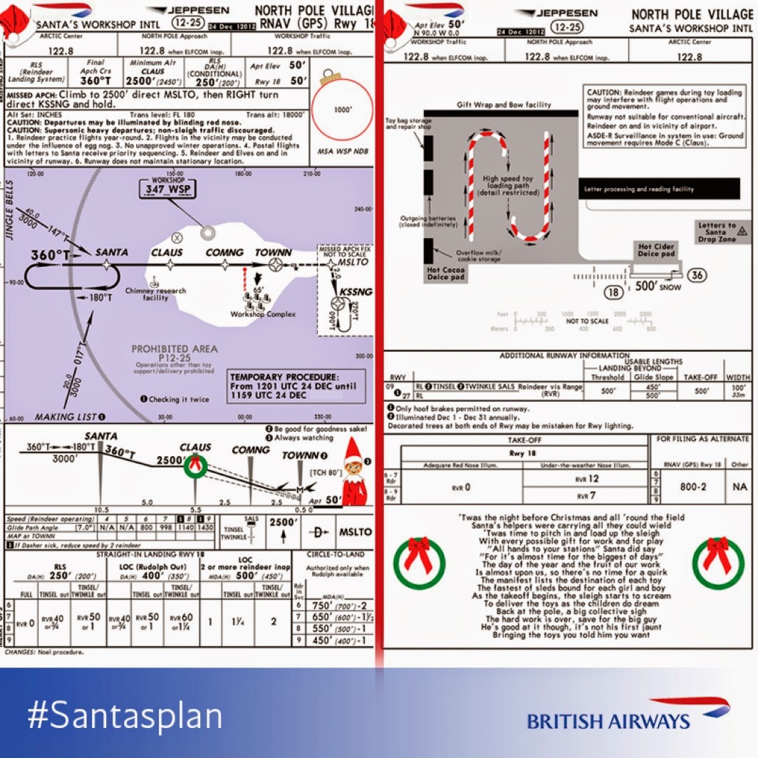
Jeppesens have been planning ahead and it looks as though Santa has been cleared to land.


I know that I posted this a couple of years ago, but thought that it was time for a reminder that you can keep track of Santa as he delivers gifts around the world. NORAD’s sophisticated tracking system follows him on his journey and if you want to make sure that you are tucked up and asleep before he arrives, check out http://www.noradsanta.org/ for his progress.

Very Best Wishes for Christmas and the New Year.


Pete Jones MBE FBCart.S CGeog
24th December 2014

E-mail: peter.jones991@mod.uk
Twitter: @geomapnut


Blog List