Thursday 31 May 2012

Queen Elizabeth I Minds the Map...


Art work by BCS Member Peter Vujakovic, for our Maplines Magazine, has been chosen for inclusion in the London Transport Museum’s (LTM) major Summer Exhibition. The exhibition about the history and creativity behind London transport maps opened on Friday 18 May 2012 and continues until 28 October. Mind the Map: inspiring art, design and cartography draws on the Museum’s art work and map collection to explore the themes of journeys, identity and publicity. The exhibition includes previously unseen historic material and exciting new work by leading artists. Over 20,000 people will read about Maplines Magazine and The British Cartographic Society as they pass through the exhibition this summer.
Peter’s cartoon satirises the attempt by Transport for London to remove the Thames from the iconic tube map in 2009. The cartoon shows Queen Elizabeth I astride the tube map indicating her displeasure at its removal and requiring that it is replaced before she takes the Royal Barge to town. The cartoon originally featured in the Winter 2009 issue of Maplines, the magazine of the British Cartographic Society. Peter is Professor of Geographical and Life Sciences at Canterbury Christ Church University, a member of the society and is a co-convenor of its Map Design Special Interest Group. See past editions of Maplines to see Peter's view of how other great minds of the past might grapple with the big issues of today!.
It is interesting to consider that this image is on display in the Jubilee year in which Elizabeth II will take to the Thames on her Royal Barge. 
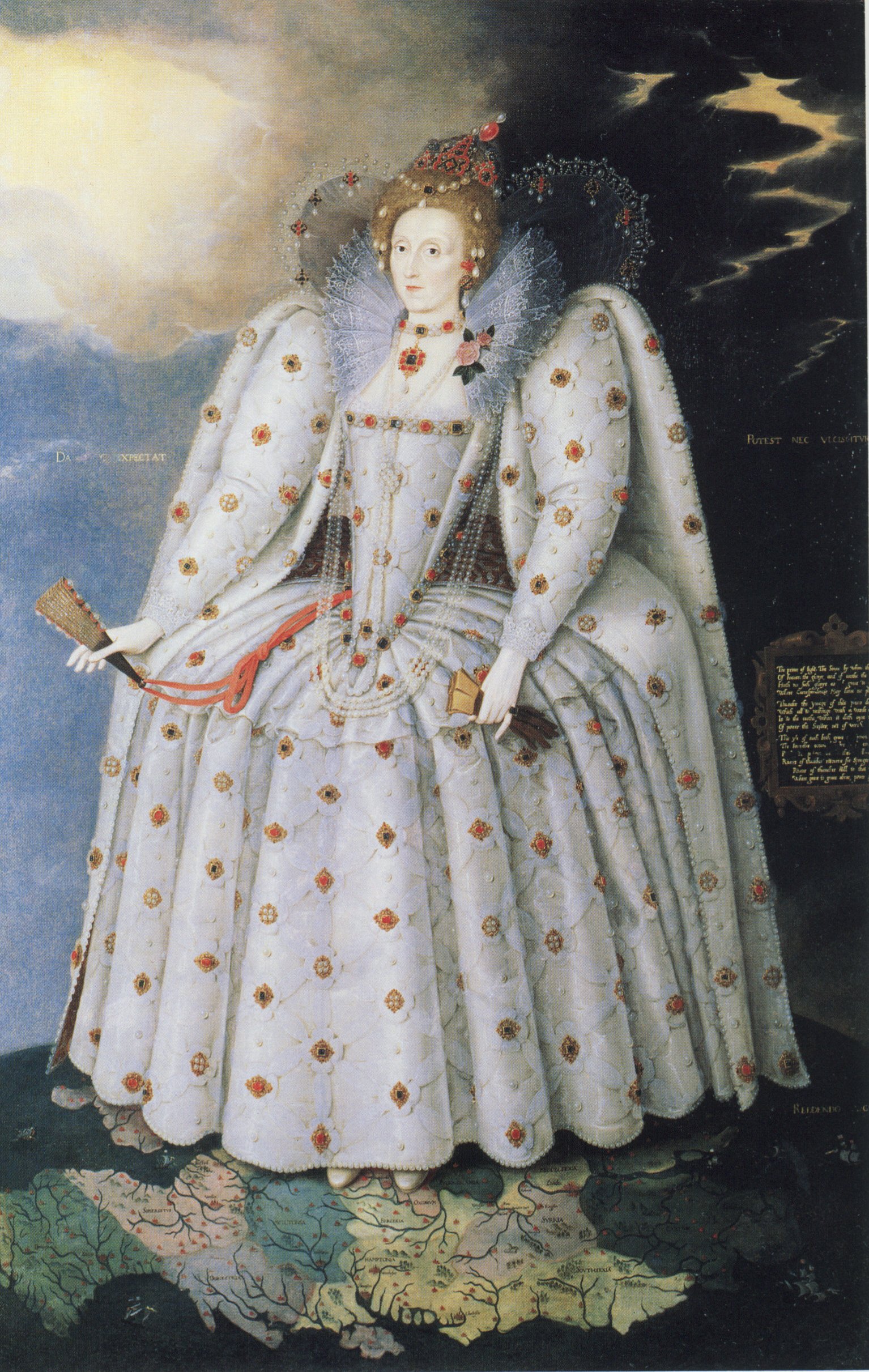
The cartoon re-works the famous Ditchley portrait (1592) in which Elizabeth I stands on a map of England.

In support of the exhibition and the London Mapping Festival The BCS are also pleased to host a free talk by Claire Dobbin, Senior Curator of the exhibition, at our
Symposium on Wednesday 13th June 2012, near Basingstoke. The 
talk is open to anyone, irrespective of whether they have registered for the BCS Annual Symposium or not. 

BCS President's Report May 2012

When I was thinking about what I could include in this report my first thought was that not a lot has happened in May but actually it’s been quite busy. BCS was represented at the GEOData event in Dublin on 1 May and this was noteworthy as we are thinking of running a BCS Better Mapping event there later in the year. It could be an important area for attracting new members.
Another successful Restless Earth Schools Workshop was held in Stoke-on-Trent on 9 May and some more of our members, who hadn’t been involved before, took part. We had a stand at the Esri UK one day Conference in London on 15 May and there was another GEOData event in Manchester on 17 of the month and on the 28th  we had a UKCC meeting in London.

Recently I had a week in Redlands at the Esri HQ and Ken Field and Linda Beale very kindly hosted a party so that I could say ‘thank you’ to all my friends there who have helped me over the last 15 years – there are about 6 BCS members over there now. On Tuesday, 29th I’m off to Dresden for the IMTA(EAME) Conference. There’ll be quite a few BCS members there too and, of course, the next ICA Conference is in Dresden in August 2013, our 50th Anniversary year. We hope to share a stand there with Maney’s.

You’ll be interested to know that we are in the initial stages of re-branding BCS which we hope to have completed by the end of the year ready for 2013. Whatever happens it’s bound to be controversial, there’s bound to be lots of ‘huffing and puffing’ but we need to do it to help with our recruiting drive and give BCS a ‘fresh face’.

Our next big event is the BCS Symposium, 13-15 June. There is still time to book your place and I’m delighted to say that the numbers are up on last year. On Wednesday morning there will be a Restless Earth Workshop for schools in the area and the GIS SIG meets that afternoon. Just a further reminder, the exhibition opens at 5pm on Wednesday 13 June with a drinks reception and is followed by a talk from Claire Dobbin, Head Curator of London Transport Museum which promises to be fascinating. A very special ‘thank you’ to our Symposium sponsors for their support: Cadcorp, Esri UK, Leica Geosytems, Europa Technologies, Victoria Litho, Newgrove, Ordnance Survey, Star-Apic and Global Mapping.

After the Symposium there is a Better Mapping event in Leeds on 19 June and a Better Mapping 2 in London on 26 June followed by a BCS Council meeting in London on 28 June. This Council meeting will be preceded as usual by a Programme Committee meeting which this time will be focusing on the 2013 BCS 50th Anniversary events. It’s only 7 months away.

Let’s hope this sunny weather continues.
Best Wishes
President of The British Cartographic Society

Blog List